Laser Scanning for Structural Engineering
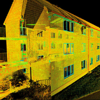
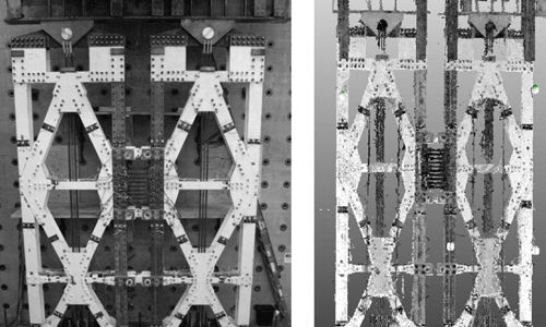
The use of high resolution three-dimensional terrestrial laser scanners as tools to capture geometric range data of complex scenes for structural engineering applications was investigated. Laser scanning technology is continuously improving, with commonly available scanners now able to capture over 100,000 points per second with an accuracy of ~1 mm. This research focused on developing the foundation towards the use of laser scanning to structural engineering applications, including structural health monitoring, collapse assessment and post-hazard response assessment. Laser scanning has the potential to play an important role in linking and sharing experimental and computational structural research.
One of the keys to this work is to establish a process for extracting important information from raw laser-scanned data sets such as the location, orientation and size of objects in a scene. A methodology for processing raw range data in order to identify objects in the scene was developed. Steps and modifications to existing algorithms are developed to advance the performance of data processing on laser scan range data sets for future application in structural engineering applications. These algorithms were demonstrated on synthetic scenes as well as validated on range data collected from an experimental test specimen and a collapsed bridge. The accuracy of the object detection was verified, demonstrating the applicability of the methodology.